463 miles of two lane roads. (161 miles of freeway. 6 miles of ONE LANE road). Tomorrow we will have a few miles of freeway, then none until Maine on July 2.
We awoke to a beautiful day after a very warm and (finally !) summer weekend in the Bay Area. We initially violated our original plan to stick to only two lane roads as we were in a hurry to get well out of the Bay. At Red Bluff, we returned to our original plan. We left I-5 at Red Bluff and went east on CA-36. We stopped at AAA to get a map. We were looking for back roads that would lead us in the direction of Burney Falls. As we had the map of California spread out on the Porsche, a stocky man in his 40’s cutting the grass stopped the mower and walked over to us, asking “Need some help?” I told him what we were looking for and asked him how the road was from 36 to CA-44 on county road A6 through Manton. His response was “Good road for a bike.” I responded, “Then it’s a good road for a Porsche." He nodded. I thanked him and we parted. Off to A6.
The first 6 miles of A6 were fine road that wove through the low foothills into Manton. At Manton, the “Road Narrows”. Did it. 6 miles of well paved road too narrow for a center stripe. Several tight and blind turns. It threaded thru old oaks and up to a ridge, then wound down to CA 44 at Shingletown.
We turned east towards Lassen.
Then the road was straight for as far as you could see. No cars. “Now or never.’ I downshifted and quickly the Boxster sped to 100 mph. Smooth. Figuring I had spent my luck with possible oncoming CHP, I throttled down to a reasonable 75.
Just north of Lassen we turned north on 89 (the other way would have eventually taken us to the cabin.) We had planned to stop at Burney Falls State Park and have lunch and open the Veuve Cliquot I had received for a retirement gift. We ate lunch and sipped champagne by the lake, then went to the Falls overlook. The water shoots over the falls…and seeped out of the rock on either side. 100 million gallons per minute.
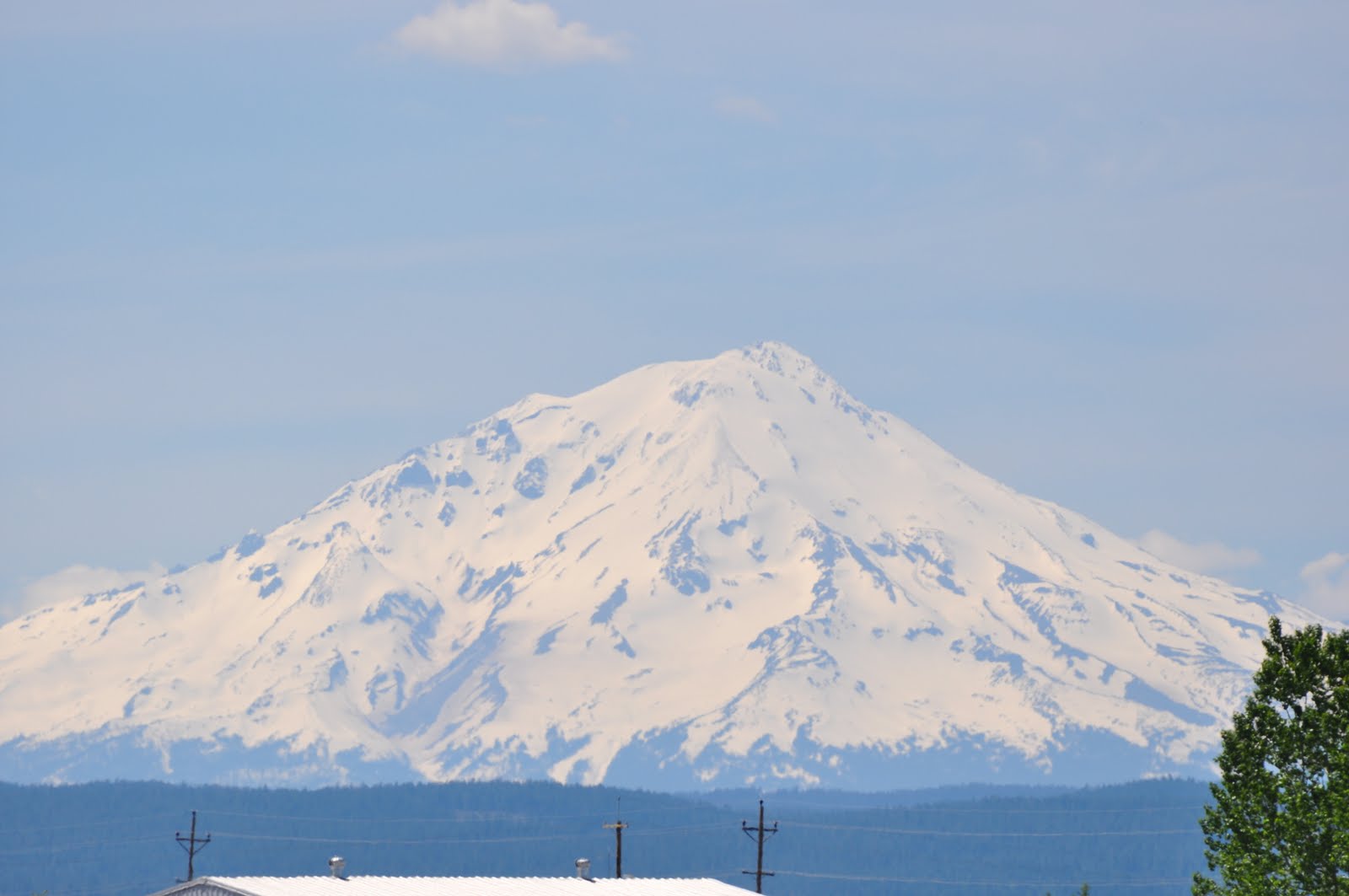
Time to make time. We continued northeast on 299 towards Alturas. We crossed several wide open large mountain valleys. Because of the wet spring snow was on many ridges and peaks, and grasslands that are often brown by now were brilliant green with wildflowers. From several vantage points as we climbed ridges we could see Lassen and Shasta simultaneously, both covered in snow. In one valley, two bald eagles flew overhead. Then we looked up and here was one sitting on the top of a pole no farther than 30 feet from us. Several miles down the road, a golden eagle was so busy having his way with roadkill in the other lane he did not flinch as we went by not 5 feet from him. Tasty meal!
We stopped in Alturas and went to the post office. I came out and Linda was engaged in conversation with a nice young man in his 20’s. He was asking if we lived in he area. He wanted to offer us his auto detailing service. When she told him we didn’t, he politely replied “I didn’t think so.” We then drove to the market. I went in to buy some stamps (the post office was closed at 4:10 and did not sell stamps in the lobby). When I returned to the Porsche, again I found Linda in conversation with a man. His age was hard to tell. He was about 45 but looked 55 and probably was a descendant of the local Paiute’s. Again the same conversation. “Are you from around here?” “No.” “I didn’t think so. We don’t see many of these cars around here.”
On we drove past Lakeview, Abert, Wagontire. Back in 1971 I was camping with Linda’s family. Her father Roger was driving an old retired Forest Service International Carry-All. We towed Linda’s uncle John’s 22 foot travel trailer. Seven of us. The Carry-All got 6 mpg towing and only had a 18 gallon tank. Range 108 miles. We stopped for gas 50 times on that trip to Glacier. One stop was Wagontire. It is still here prepared to serve the traveler, 50 miles from nowhere.
Through Burns OR and then up through Devine Canyon Scenic Area. It was ‘devine’. Truly. Again everything was green that often is brown. Standing water in many places along the road. This good 2 lane road: well paved, good grade and alignment. It was 8 pm and we passed saw one car in each direction for the first 55 miles.
Seneca, OR. Population 100 when all the relatives are in town. We drove through there just before dusk. Three boys about 13 sat on their bicycles. As we drove by their heads turned like cartoon characters and their mouths opened. Seneca is 30 minutes from the nearest town and 2 hours from Bend and 5 hours from Portland.
We spent the night at the Best Western but had intermittent internet access. So Tuesday am as I write this I am at the local coffees shop. The Outpost. As a came to the crosswalk to cross the street from the hotel, a man driving a pick up stopped to wave me across. I am not in the Bay Area. I stood outside the door of the Outpost looking at it, and the same man had parked his truck and yelled at me from 50 feet away “Go on in. They got good coffee if that us what you’re looking for.” And they did. And internet.
And that is how Day 1 ended and Day 2 began.
Off We Go!

County Road A6

Yep. It's Summer!

Burney Falls

Mount Lassen

Mount Shasta
Green Grass and Snow in the Desert

The Sky Couldn't Be More Blue

The Abert Escarpment en route to Burns, Or

No comments:
Post a Comment