Miles 285 (3225)
Two Lanes 285 (2706)
Top down 285 (2779)

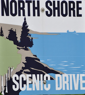
We awoke to fog, ate, and started traveling. Shortly up the road was Gooseberry Falls State Park. The falls cascade through three sets of cataracts. After yesterday’s torrential rains, the falls were full and powerful. This is iron ore country, and the falls were reddish brown.
Then on to Split Rock Light House. Because of a huge storm Nov. 28, 1905, damaging 29 ships, Congress appropriated $75,000 to build a lighthouse and fog horn on this bluff of shear cliff rock known as Split Rock. United States Steel was the owner of one third of all ships damaged or lost that day. The area had earned the reputation of being the most dangerous waters in the world, as seven ships lost that fateful day sank within 15 miles of Split Rock. 231 sailors lost their lives during the winter of 1905-06 on Lake Superior.
And it was foggy today. As we drove north towards the Canadian border the fog slowly lifted. At Grand Portage we discovered the Grand Portage National Monument. http://www.nps.gov/grpo/index.htm.
Grand Portage National Monument is located on the north shore of Lake Superior in northeastern Minnesota that preserves a vital center of fur trade activity. The Grand Portage is an 8.5-mile (13.7 km) (2720 rod) footpath which bypasses a set of waterfalls and rapids on the last 20 miles (32 km) of the Pigeon River before it flows into Lake Superior. This path is part of the historic trade route of the French-Canadian voyageurs between their wintering grounds and their depots to the east. “North canoes” would carried (portage: to carry boats and supplies overland, or the trail upon which they are carried) across this stretch along with their contents. Often three round trips were needed to move a canoe and its supplies.
Composed of the Pigeon River and other strategic interior waterways, as well as the Grand Portage and many other important land portages, this route was of enormous importance. It provided quick water access from Canada's settled areas and Atlantic ports to the fur-rich NorthWest. All supplies from Montreal to the Canadian NorthWest passed through here. All furs from the NorthWest passed back through here. For two weeks every July the traders and trappers would meet in a “rendezvous” to exchange goods and news, and to eat and drink hearty.
Then across the border to Ontario. The border guard asked us how where we were going in Canada. We answered “Newfoundland”. She raised her eyes, then asked if we were driving all the way there. The smart ass in me answered, “We have to take the ferry the last 300 miles.” Fortunately, she still smiled.
We drove along the northwest and northern shores of Lake Superior, the largest body of fresh water in the western hemisphere, and stopped for the night at a B&B in the little lakeside burg of Rossport. There we met Gary.
Gary is from Sebastopol. He retired in December and was riding his BMW motorcycle solo across the continent to see his daughter who lives in Toronto. He is blogging slong the way. He is a very nice man who plans to head straight home after a week in Toronto, although his wife has encouraged him to take his time. He is unsure which of the several messages that could mean! His ride has been good. In general the rain flies off his windshield and up and over him. Unless he is stopped in traffic. He got drenched in Calgary, and with the plug in heated jacket he wears, once he was soaked, steam was rising from his body at traffic lights.
To follow Gary, www.findgary.blogspot.com
Wildflowers everywhere!


Gooseberry Falls

Looking for Rocks

Split Rock Lighthouse

The Grand Portage

The Fort at Grand Portage

Becoming a Furrier

What to wear to the Opera?

The Stern Scottish Partner wants more profit!

The birch bark "north canoe"

North Shore Lake Superior

Signs


No comments:
Post a Comment